
Early this year when I started to log more running miles than cycling miles someone asked me what I was training for, I responded with, “Life”. Even with the added base of running my legs were a little heavy for Day 3.

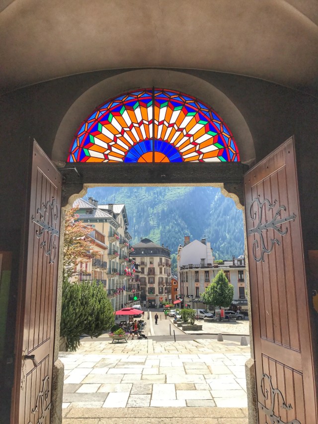
Knowing that time was a precious commodity I realized I could tackle the route I had planned even if I was hiking the whole time. My goal was to do a similar route to the day before, only on the other side of the valley. I started in town and hiked up to left towards Montenvers, I opted for the shorter route and still took a good 90 minutes to get to the top.
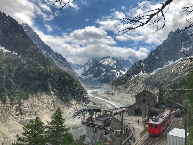
Only at the top did I realize that there was a train option. For only seeing 2 people on the trail the view point was suddenly littered with unaccompanied minors throwing rocks and adults wandering aimlessly around. It was a bizarre spectacle to come out of the solitude of the trail and emerge onto a boisterous scene of people. 
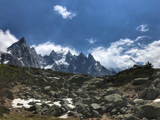
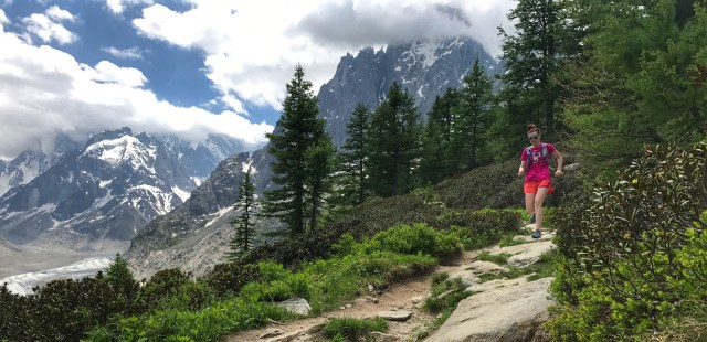
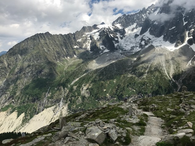
From there I hiked up towards Signal Forbes, which was a lot of rock stairs and questioning if I took the right trail. Once I reached the peak it flattened out a bit but I still opted against running due to all the jagged rocks waiting to claim me as their victim (no need to learn about the French medical system).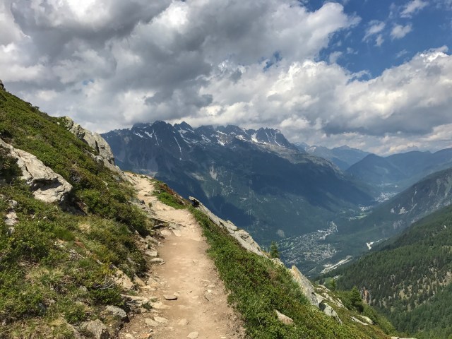 The trail smoothed out eventually and my walk turned into a trot and then back to a walk and then back to a trot as my quads were a little blown out. I started calling it the “wrot” and could only wonder what people thought of me (fortunately there were not a lot of people on the trail at this point).
  The views were still breathtaking, not so much the other side of the valley but the ridge line that I was running on offered vantage points up towards the highest peaks.
I made it to De L’Aiguille and was again mystified at the cable car running up from the town. No way was I getting on that thing. I sat down and waited a few moments hoping that the clouds would break and I could get a good picture of Aiguille Du Midi.

There is also a cable car that runs up to that peak at 3842 meters, I almost threw up thinking about that option. I wandered around a bit debating if I should hike up to Lac Bleu or head down, I saw a sign that said it was only 15 minutes so opted towards the lake. The problem with the maps and the signs is that none of them have distance and only times, and I’m still not sure who those times are based. 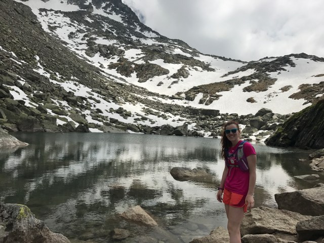 The lake was pretty but with the cloud coverage didn’t offer as much of a view as Lac Blanc the day before. I sat for a few minutes, reapplied some sunscreen, ate some dried mangos and contemplated just how much sunscreen I had ingested at that point.
I started down, which the sign said time to Chamonix about 2:30 but I figured it would be 1:30. The first steps down the trail I wasn’t so sure, it was steep and the drop offs were more perilous than the Grand Canyon.

I was definitely hugging the non-exposure side at some moments and also scooting along to lower my center of gravity. It’s times like these that I really think about lasik eye surgery so I can have accurate depth perception (Background: I only have one bad eye but hate touching my eye so never wear contacts and only glasses for reading and school, which is probably why I crash a lot while biking or trip while trail running. My optometrist once stated, “I can’t believe you’re still alive with this depth perception.”).  The trail was filled with a lot of switchbacks and continued on the steep grades, even when the exposure disappeared. I still continued to awkwardly shuffle down between a walk and a trot, trying not to jar my quads too much. I made it down in about 1:40 and bee-lined it to the grocery store to get candy (I ate all my skittles from the day before (Kara, I promise I will fit in my bridesmaid dress-haha)).

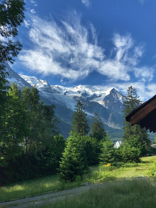
For my last day I knew I wouldn’t have too much time because I had to catch the shuttle back to Geneva. I opted for a short loop on the opposite side of the Chamonix Peaks so I could take in those views one last time. I also thought my legs would be completely shot but surprised me when they were good to run both up and down (fortunately not super steep grades). 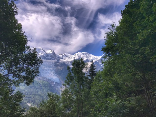 I only did about 2 hours and stopped a lot to take pictures. There is a race around Mont Blanc, I don’t think there is anyway I would survive the race and I’d probably spend wayyy too much time taking photos. It seems like the route goes through enough little towns that you can run it with minimal support, which would be really fun if anyone reading this is interested…
As I was getting packed up to leave I had the thought that I wish I could spend more time here, and I realized that I have that thought about almost anywhere I go. It’s certainly a great privilege to be able to explore this world.

More photos:


Nice!! Love you. Praying for Nayaf.
LikeLike